How the Galois 3D LiDAR Camera by Realsee Is Transforming Real Estate Visualization
Introduction
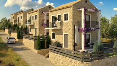
The real estate industry is rapidly changing with the help of advanced technology. Among the most impressive innovations is the Galois 3D LiDAR camera by Realsee, which is reshaping how real estate professionals capture, view, and share property visuals. Traditional photos and videos can no longer meet the growing demand for immersive and accurate property tours. The Galois 3D LiDAR camera steps in as a game changer, offering high-precision 3D mapping and ultra-detailed imaging that creates virtual tours so realistic they make clients feel like they are walking through the property in person.
This innovative camera system is designed to help real estate agents, property developers, and interior designers present properties in the most engaging way possible. Realsee has combined LiDAR (Light Detection and Ranging) technology with advanced image processing to deliver seamless 3D models and panoramic experiences. As a result, both buyers and sellers can benefit from a deeper understanding of space, lighting, and structure—all before setting foot inside the building.
What Makes the Galois 3D LiDAR Camera Special
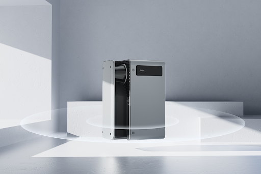
The Galois 3D LiDAR camera stands out for its cutting-edge technology and user-friendly design. Unlike ordinary 3D scanners or cameras, it uses LiDAR sensors to measure depth and dimensions with incredible accuracy. This allows users to capture realistic spaces in minutes without needing multiple devices or complex editing tools. The camera collects millions of laser points, which are then processed into a detailed 3D environment that users can navigate smoothly.
Realsee designed the Galois camera to deliver precision, clarity, and speed. It doesn’t just record visuals—it understands depth and structure, meaning it can generate true-to-scale digital twins of any environment. Whether for luxury homes, offices, or commercial spaces, this camera helps real estate professionals create reliable digital assets that can be used for virtual staging, walkthroughs, or renovation planning.
How Realsee Is Redefining Real Estate Marketing
Realsee, the company behind the Galois 3D LiDAR camera, has been leading the movement toward intelligent visualization in real estate. Their goal is to replace static property listings with dynamic, interactive experiences that help clients make faster, more confident decisions. By merging LiDAR mapping with AI-powered visualization tools, Realsee empowers agents and property managers to market spaces more effectively and stand out from competitors.
This shift from traditional photography to 3D scanning is revolutionizing how potential buyers experience properties online. Instead of relying on a few wide-angle shots, clients can now explore every corner of a space, zoom in on details, and visualize how furniture or lighting would look in real life. The immersive nature of these virtual tours builds trust, reduces unnecessary visits, and shortens sales cycles.
Improving Accuracy and Efficiency in Property Scanning
One of the biggest advantages of the Galois 3D LiDAR camera is its unmatched precision. It captures accurate spatial data, which helps eliminate errors in measurements and visual representation. For architects and real estate developers, this means reliable blueprints and models that can be used for renovation, design, and planning without additional scanning or manual input.
Moreover, the Galois camera speeds up the process of capturing spaces. Traditional 3D scanning can take hours, but Realsee’s solution completes the task in a fraction of the time. This level of efficiency allows professionals to handle multiple projects quickly, saving time and reducing costs. With its smart automation features, the device makes 3D scanning accessible even to beginners who may have limited technical knowledge.
Enhancing the Buyer’s Experience Through Virtual Tours
Buyers today prefer to explore properties remotely before scheduling a physical visit. The Galois 3D LiDAR camera by Realsee makes this possible by producing lifelike virtual tours that are both detailed and interactive. Using LiDAR-based depth sensing, the camera captures accurate room layouts, wall textures, and lighting conditions, giving viewers an authentic feel of the property.
With Realsee’s visualization tools, potential buyers can move through virtual spaces as if they were physically there. This immersive experience not only enhances engagement but also helps clients understand the true scale and design of the property. For real estate agents, offering such advanced virtual tours increases customer satisfaction and builds a reputation for innovation and transparency.
Benefits for Real Estate Professionals and Developers
For real estate professionals, the Galois 3D LiDAR camera offers multiple advantages beyond visualization. It reduces the time spent on traditional photography and manual measurements while improving the overall quality of listings. Agents can easily create 3D floor plans, highlight special property features, and integrate the visuals into websites or mobile apps for easy access.
Developers and architects also benefit from this technology. They can analyze properties more accurately during planning and construction phases. By using Realsee’s digital models, teams can collaborate remotely, make design decisions faster, and avoid costly mistakes. The efficiency and accuracy that come with LiDAR imaging are becoming essential tools in modern real estate workflows.
The Future of Real Estate Visualization with Realsee
As Realsee continues to innovate, the future of real estate visualization looks even more exciting. The integration of artificial intelligence, cloud computing, and LiDAR imaging will make virtual property experiences even more immersive and data-driven. Imagine being able to adjust furniture layouts, lighting, or wall colors in real time during a virtual tour—all powered by Realsee’s technology.
The company’s vision extends beyond real estate. With advancements in spatial computing, the Galois 3D LiDAR camera could also find applications in interior design, construction, and even smart home integration. Realsee’s dedication to improving digital representation is setting new standards across industries and pushing the boundaries of what’s possible in visual technology.
Conclusion
The Galois 3D LiDAR camera by Realsee is not just a tool—it’s a complete transformation in how properties are visualized, marketed, and sold. Its powerful LiDAR technology, paired with Realsee’s advanced visualization software, is bridging the gap between the physical and digital worlds. Real estate professionals now have the ability to offer immersive tours, precise 3D maps, and interactive experiences that make property exploration more engaging and reliable than ever before.
As real estate continues to evolve, tools like the Galois 3D LiDAR camera will remain at the forefront of innovation. With its focus on accuracy, efficiency, and realism, Realsee is setting a new benchmark for how people see and experience spaces in the digital age. This is not just the future of real estate visualization—it’s the future of how we connect with the spaces we call home.